

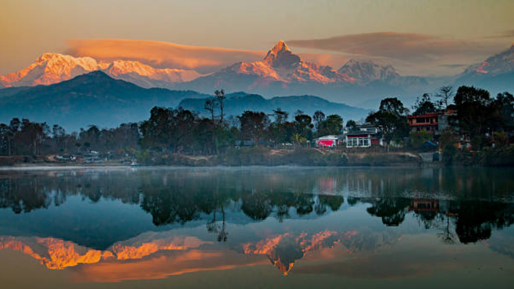
On any clear morning, Pokhara looks like it has always been this way. Paragliders spiral down over Phewa Lake. Lakeside cafés fill with trekkers planning routes into the hills. Boats drift past the water’s edge, and beyond them, close enough to touch, the Annapurna range rises in a wall of white.
It is one of the most photographed views in Nepal, and one of the easiest to take for granted flat, green, fertile land in the shadow of some of the tallest mountains on Earth, ringed by lakes that seem to have been placed there for the postcards.
But that flat land was not always there. The valley Pokhara sits on, the lakes that make it famous, even the soil that feeds it all of it was built, suddenly and violently, by one of the worst disasters ever to strike the Himalaya.
It happened about 800 years ago. Nobody alive remembers it, no one wrote it down, and until recently, no one fully understood what it was. Scientists have only just pieced it together, and the story starts not in Pokhara, but with a much stranger puzzle: a mountain that mysteriously refuses to wear away.
For years, geologists had a nagging problem with the tallest Himalayan peaks.
Glaciers are supposed to be nature’s demolition crew they grind valleys down fast, carving out the deep gorges that surround places like the Annapurnas. But the summits themselves, the very highest points, barely seem to erode at all.
There is a name for the theory that should explain this the “glacial buzzsaw,” the idea that ice and freeze-thaw cracking should trim mountains down to a certain height and keep them there.
The trouble is, the tallest Himalayan peaks stand nearly 3,000 metres above the altitude where that buzzsaw is supposed to do its work. The theory didn’t fit the mountains in front of it. Something else had to be limiting how tall these peaks could get or how they eventually came back down.
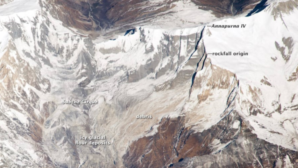
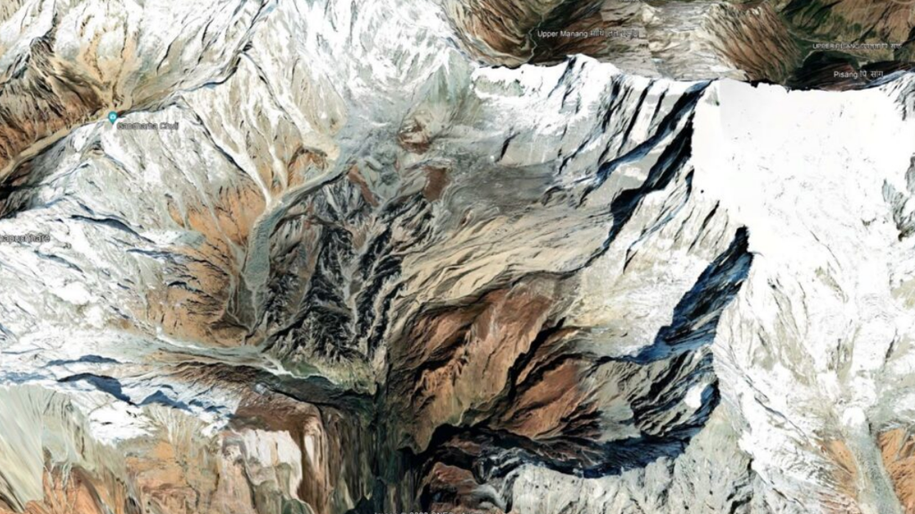
To find out, a research team led by geologist Jérôme Lavé went looking in a strange corner of the Annapurna massif a deep, bowl-shaped hollow called the Sabche Cirque, tucked between the peaks of Annapurna III and Annapurna IV.
From a distance, it looks like it should hold a glacier. Instead, it is packed with hundreds of metres in places, over a kilometre — of pale, shattered rock, worn by wind and water into strange spiky towers. Earlier visitors had assumed this was old glacial mud or lake sediment. When Lavé’s team examined it closely, they found something else entirely dense, angular, finely crushed limestone, cemented together the unmistakable signature of a single, sudden, catastrophic rockslide, not a slow build-up of silt over centuries.
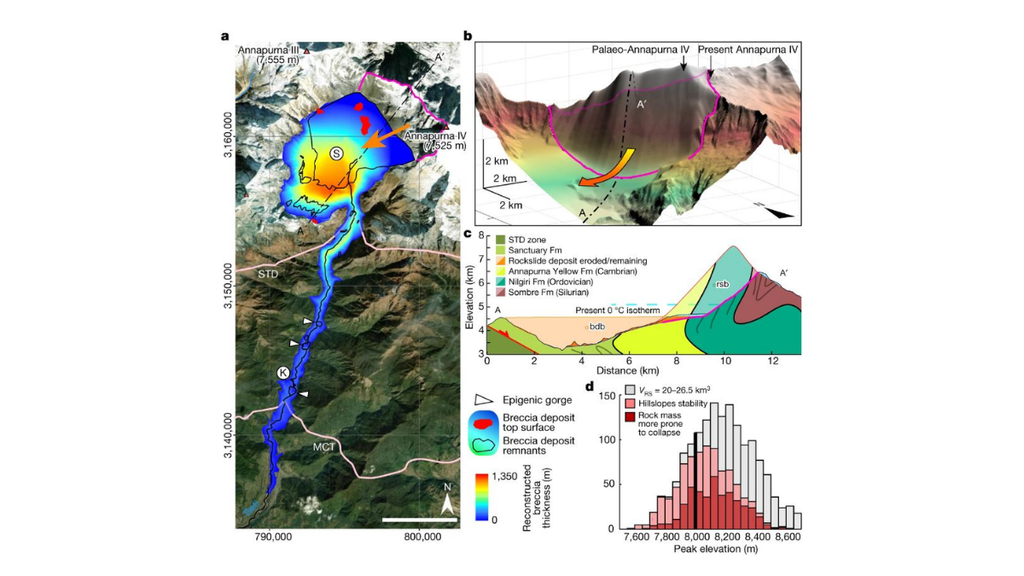
That discovery led to the reveal at the heart of their 2023 study, published in Nature Annapurna IV, as it stands today, is not the mountain it used to be and the strange filled-in bowl the team found is the crime scene, not just an odd geological footnote.
The peak’s official height today is 7,525 metres respectable, but well short of the 8,000-metre club that includes its neighbours, Annapurna I and Annapurna II.
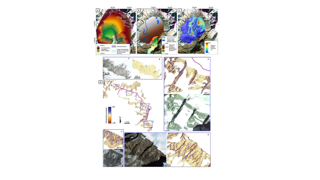
By measuring how much rock is missing from the Sabche Cirque and modelling what shape the mountain would have needed to produce it, the researchers calculated that before the collapse, Annapurna IV likely stood around 8,100 metres roughly 600 metres taller than it is now.
There is a 65 to 76 percent probability, by their estimate, that the mountain once crossed the 8,000-metre line entirely, which would have made it the Himalaya’s 15th “eight-thousander,” a title that has since vanished from every map and record book.
It didn’t erode away gradually. It came off all at once, in a single catastrophic collapse that sheared roughly 500 to 600 metres off the summit and sent the debris crashing down nearly three kilometres of vertical drop into the Sabche Cirque below.
The volume of rock involved was about 23 cubic kilometres enough, by rough comparison, to rebuild the Great Pyramid of Giza almost nine thousand times over. Researchers call it the largest rockslide ever documented anywhere in the Himalaya.
Here is the twist that turns this from a geological curiosity into a story worth telling the same catastrophe that tore the top off a Himalayan giant is the reason Pokhara exists as a livable valley today.
The rock didn’t stay in the Sabche Cirque. Over the following century or so, rain, rivers and glacial meltwater tore into the loose, shattered debris and swept it downstream through the Seti River, into the basin that is now Pokhara valley.
Researchers found the valley floor was filled shockingly fast starting around 1200 AD, at roughly a metre of new sediment every year for about a hundred years, using some five cubic kilometres of gravel and rock.
That sediment is why Pokhara has flat, farmable, buildable land at all, rather than a narrow gorge. It also dammed several side streams as it piled up, creating the lakes that now draw the tourists Phewa, Begnas, Rupa and others.
Some of the finer material travelled even further, turning up more than 300 kilometres downstream along the Narayani river system, with traces possibly reaching all the way to the plains of the Ganges in India.
In other words, the disaster that flattened the summit of a Himalayan giant 800 years ago is the same event that created the land people now live, farm and build hotels on in Pokhara.
Scientists are confident about the timing because three completely independent dating methods all point to the same narrow window.
Radiocarbon dating on plant matter trapped beneath the debris gave a date of around 1190 AD. A technique called luminescence dating, which can detect the moment sediment grains were last exposed to heat and friction, pointed to roughly the same period. And a third method, which measures how long boulders on the surface have been exposed to cosmic rays, landed on about 1196 AD. When three unrelated clocks agree that closely, geologists take it seriously this was one event, not layers accumulated over generations.
The scientists behind the study think this collapse wasn’t a one-off fluke, but a clue to how the very highest Himalayan peaks behave over long stretches of time.
At extreme altitude, the ice gluing rock together makes a mountain face unusually strong, letting it grow taller and steeper for centuries without wearing down the way lower slopes do. But that strength has a limit. Instead of slowly eroding, an overbuilt peak eventually fails all at once a rare, sudden collapse rather than a gradual grinding-down. If that’s right, it may explain why the tallest summits in the range seem to defy the glacial buzzsaw for so long, right up until they don’t.
What actually caused the mountain to fail is less certain, and the researchers are upfront about that. It doesn’t appear to have been a known earthquake Nepal’s historical record shows major quakes around 1100, 1255 and 1344 AD, but the dating of the rockslide doesn’t line up neatly with any of them, though the possibility of an unrecorded medieval quake can’t be entirely ruled out.
The leading theory instead points to climate the collapse falls within a known centuries-long warm spell called the Medieval Climate Anomaly, when the high Himalaya may have been more than 1°C warmer than the period before it. At extreme altitude, permafrost ice that acts like glue holding fractured rock together is often the only thing keeping a steep mountain face from failing.
A warmer spell may have thawed that glue just enough to tip an already unstable slope over the edge. The researchers are careful to call this a leading theory, not a settled fact.
None of this is safely locked in the past. The upper flank of Annapurna IV, the exact area that failed 800 years ago, is still described by scientists as raw and unstable, and it continues to shed rock.
In May 2012, a much smaller rockfall broke away from nearly the same spot on the mountain. It triggered a flood down the Seti River that killed more than 70 people near Pokhara a miniature, modern echo of the same slope failing in the same place, with the same basic mechanics: rock and ice breaking loose high in the mountains, overwhelming a river, and devastating people living far downstream.
That pattern repeated on a much larger and more devastating scale just days before this piece was written, when a rock-and-ice failure on the north face of Langtang Lirung sent a flood down the Bhote Koshi and Trisuli river system on the Nepal-China border on August 26, 2026.
The physics were the same as what happened at Annapurna IV eight centuries ago a high-altitude slope giving way, a temporary dam of debris, then a sudden release downstream just compressed into hours instead of a century, and striking a valley now filled with roads, bridges, hydropower plants and border trade infrastructure that simply didn’t exist in the 1190s.
Where the medieval collapse quietly built a valley over a hundred years with almost no one there to be harmed by it, the modern version struck a crowded, developed corridor in minutes.
That is the sobering half of this story. Scientists studying Annapurna IV have said plainly that if a rockslide of similar scale happened again today, the outcome for Pokhara now Nepal’s second-largest city, home to hundreds of thousands of people would be catastrophic, potentially burying the valley under tens of metres of debris.
It is a rare hazard, but not an imaginary one, and there is reason to think that a warming climate makes this kind of high-altitude failure more likely, not less, as the ice that glues these mountains together keeps retreating.
So the next time you’re sitting at a lakeside café in Pokhara, watching a paraglider drift down over Phewa Lake with the Annapurnas glowing behind it, it’s worth remembering what you’re actually looking at. The flat ground under your feet, the lake in front of you, the mountains behind it slightly shorter than they used to be none of it is as permanent, or as peaceful, as it looks.
It was built by violence once. The same slopes are still capable of it now.
